The Shijigtiin canyon of the river Khovd-Gol. Information. Guide
TheShijigtiin canyon (mong. Шижигтийн хавцал) located lower section of the river Khovd-Gol, approx. 100 km from it mouth, 80 km to the north from Khovd town, 100 km to the sputheast from Olgii town. The river crosses the Tsambagarav and Altan-KhuKhii-Nuuru mountains ranges; formed the canyon 500-800 m depth and approx. 10 km length. From the beggining to the end of the canyon the river drops 80 meters, average gradient is 7.07 m/km. In the canyon is a few difficult rapids, Kanjone yra keletas sudėtingų slenksčių, which difficulty depends on the water level. Average perennial discharge in the canyon: May - 50 m3/s, June - 190 m3/s, July - 200 m3/s, August - 120 m3/s, September - 55 m3/s.
The put in point can be reached from Olgii or Khovd towns via the center of somon Bayan-Nuur village. From here approx. 20 km to the south. To leave the river - drive via Erdeneburen (approx. 20 km to the south) to Khovd town.
Detailed guide
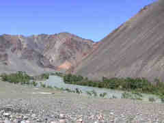
0.0 At right bank of the river not high mountains, to the left valley wide. The river flows in one main riverbed, in places branches off a small canals. Current quite swift, dominant width of the riverbed approx. 200 m. Average gradient to tributary the Tsetsegt-Gol 1.11 m/km.
 |
 |
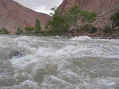 |
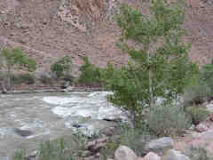
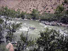
| Upstream the canyon of the Khovd-Gol | The Shijigtiin canyon of Khovd-Gol | The Shijigtiin canyon of Khovd-Gol |
9.5 The river enters the canyon, narrows to 70-90 m. In the riverbed powerful easy rapid. WW 2+.
10.1 Right tributary the Tsetsegt-Gol. Dowstream the tributary rapid. At the end of rapid high stoppers. The river width in the rapid 45-65 m, the lenght of rapid approx. 300 m. Downstream approx. 200 m swift current. WW3-/3.
10.5 Begins long (approx. 1100 m length) rapid. The river width 50-100 m. Current very strong, local 'potholes'. Most difficult place is at the end of rapid, just before island - 'potholes' and stoppers across the river. WW 3+.
11.2 Left from main stream 2 islands. A bit downstream in the center of river small island.
11.6 Long island in the center of river. The rapid ends.
12.1 Long island, just upstream approx. 200 m length rapid. WW 3-/3.
 |
 |
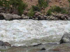 |
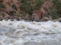
| The Shijigtiin canyon of Khovd-Gol | The Shijigtiin canyon of Khovd-Gol | The Shijigtiin canyon of Khovd-Gol |
12.3 50 m downstream from the island end rapid begins. At the beginning of the rapid the river narrows to 35 m, at the end of the rapid narrows again to 40 m. Dominating the river width in the rapid is 70 m. Gradient big, local 'potholes', stoppers across the river. The rapid lenght is 800 m. WW 4/4+.
13.1 The rapid ends. Downstream swift current, local short and easy rapids. WW 2, max. WW 3-.
13.5 The small island in the center of the river.
14.3 Island left from the main stream.
 |
 |
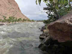 |
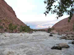
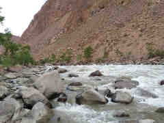
| At the end of Shijigtiin canyon | At the end of Shijigtiin canyon | At the end of Shijigtiin canyon |
14.6 Island right from the main stream. At the island and downstream 600 m lenght rapid. WW 3.
15.9 Just after the river turn to left rapid begins. 200 m before the beginning of rapid the small island. In first part of the rapid (300 m length) the river narrows to 30 m, big gradient, high stoppers. The second part a bit easier, the river wider, local 'potholes' and stoppers. The rapid ends approx. 200 m downstream of the small island. Overall length of rapid approx. 800 m. WW 4/4+.
16.4 The island of 100 m length. 200 m downstream the island the rapid ends. From next rapid is separated by approx. 100 m strong current.
16.8 The difficult rapid begins. The river width in the rapid 35-50 m, big gradient, 'potholes', stoppers. The rapid length 800 m. WW 4+/5-.
 |
 |
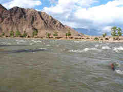 |
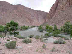
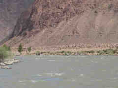
| The end of Shijigtiin canyon | The end of Shijigtiin canyon | The Khovd-Gol downstream the Shijigtiin canyon |
17.5 The rapid ends. Downstream the rapid the river leaves the canyon, continuous easy rapids, the river width 70 m. WW 2+.
21.7 Right tributary the Ulyastain-Gol. Downstream the river divides to branches.


