The river Dund-Tsenkher-Gol. Information about the river
The river Dund-Tsenkher-Gol (The Middle Blue River) (mong. Дунд цэнхэр гол). The source in glaciers of the Monkh-Khairkhan mountains range, flows through small lakes to the east and calls the Shuurkhain-Gol. Downstream tributary the Nariin-Gol change the name to Bortyn-Gol, downstream tributary the Bayan-Sairbyn-Gol turns to the northwest and again change the name to Dund-Tsenkher-Gol. Flows to the north through Monkhkhairhan village, before leaving the mountains turns to the east; leaves the mountains and flows through the dry plain to the east northeast through Tugrug Gol town (center of somon), divides to branches and calls the Tugrug-Gol (mong. Төгрөг гол). A bit downstream Tugrug Gol town divides to a lot of branches, turns to the north and very broad delta inflows into the Khar-Us Lake. The river lenght 172 km. The river from the source to the Khar-Us Lake drops approx. 2 kilometers. The delta of the river crosses the Genghis Khan Wall.
Detailed river guide
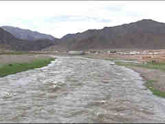
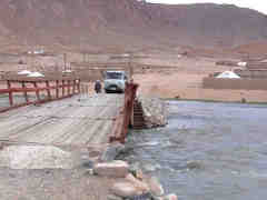
123.1 Bridge. Right Monkhairkhan - center of somon. The village can be reached by unpaved road from Khovd town. Along the river is unpaved road/track.
The river width 15-30 m, swift current, continuous rapids, the river in places divides to branches. WW 2+, max. WW 3-. Average gradient to tributary the Ust-Salaa 9.45 m/km.
 |
 |
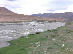 |
| The river Dund-Tsenkher-Gol at Munkhkhairkhan | The river Dund-Tsenkher-Gol at Munkhkhairkhan | The river Dund-Tsenkher-Gol at Munkhkhairkhan |
117.6 Left watery tributary the Ulyastyn-Gol flows from glaciers of the Monkh-Khairkhan mountains range. Across the river dam. A bit downstream right shed and stockyard.
116.6 The river begins to turn a large loop around lonely hill on the right. Just before the hill 4 kurgans (burial mounds).
112.9 The river divides to branches, becomes a bit easier. Swift current, local easy rapids. WW 2, max. WW 2+.
111.1 Right dry tributary Lamasain zavsar.
109.7 Right dry tributary Ust-Salaa. Average gradient to 96.4 km 6.24 m/km.
104.8 Left tributary the Alag-Tekh-Gol. Just before the tributary sheds and stockyards.
102.8 Left the dry creek. At it mouth close to the river 4 kurgans (burial mounds).
100.6 Right the dry creek.
99.4 Right the dry creek.
99.1 Right shed.
98.9 Right the small dry creek. The river flows in one riverbed. Begins long (approx. 1 km length) rapid. The river width in the rapid 15-25 m, gradient big. More difficult is the beginning of the rapid ant part of the rapid just after the mouth of the left creek. Overall grade WW 4. Scouting from the road on right bank.
98.5 Left the small dry creek. Left stockyard.
97.9 The rapid ends. The river flows in one riverbed. Current strong, but there are no rapids. WW 2+.
97.1 The long, large island begins. At the banks small forest. Keep left branch.
96.4 Left the small dry creek. The island ends. A bit downstream river turns a large, sharp loop. Average gradient to the bridge at 93.1 km 16.06 m/km.
94.9 The small forest ends. The difficult rapid begins. Before the rapid the small island (keep the left branch, here is short rapid), just before the rapid the river widening from 10 to 25 m, the road on right close to the river. The rapid length 300 m, very big gradient, the high, steep drops. The width of the river in the rapid approx.10 m, in some places narrows to 6 m. More difficult is the end of rapid. To the next rapid approx. 50 m strong current. Grade WW 5. Scouting from the right bank.
94.6 Begins next difficult rapid, approx. 500 m length. Gradient is very big, the drops follows each other, dominant width of the river at the rapid is 15 m, in some places the river narrows to 3 m. Most difficult part of the rapid is at the middle, a big boulders narrows the riverbed, the high drop. At the end of the rapid, just before the bridge a small island. Scouting from the right bank. Grade WW 5.
94.0 Bridge. Downstream the bridge continuous rapid, big gradient, drops. Dominant width of the river 15 m. Overall grade of the section WW 4+. Scouting from the left bank.
93.1 Bridge. Just after the bridge the high drop. Downstream the river a bit easier, between the rapids appears a short intervals of swift current. WW 4-/4. Left bank steep. Average gradient to 88.9 km 18.33 m/km.
91.9 The difficult section of 700 m length. Up to Grade WW 4+. Scouting from the right bank.
90.7 Right clearly visible the valley of the small tributary. Right stockyard. Downstream the character of the river remains the same. WW 4-/4, max. 4+. Scouting from the right bank.
88.9 Average gradient to 85.8 km 11.29 m/km.
 |
 |
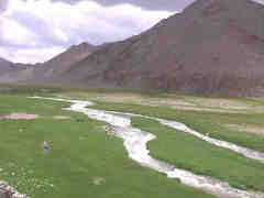 |
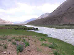
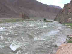
| The river Tugrug-Gol leaves the mountains | The river Tugrug-Gol leaves the mountains | The river Tugrug-Gol. Lower section |
87.6 The river leaves the mountains. To the right branches off a long duct. The river difficulty decreases to WW 3/3+, max. WW 4.
85.8 To the right branches off a long duct. Although the river flows through plains, current speed and gradient remains high. Grade WW 2+, max. WW 3. Average gradient to 75.9 km 9.60 m/km. To finish the trip is more comfortable at the road ford a few kilometers downstream.
79.0 Right close to the river not high, narrow ridge.
73.8 Right close to the river the mountain Bulangiin-Khar (1622.5 m above sea level). A bit downstream the river divides to a lot of branches.


