The river Bulgan Gol. Information about the river
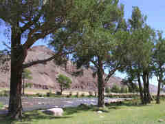
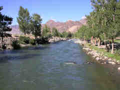
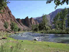
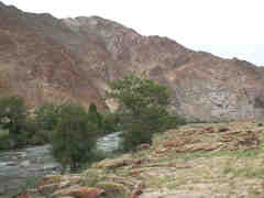
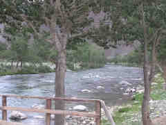
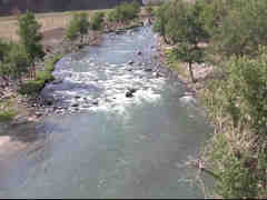
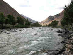
The river Bulgan-Gol flows in southwest part of the Mongolian Altai mountains in Mongolia and China. The suorce is at the foot of the peak Dushin-Ula (3816 m heigh), in the Main Mongolian Altai mountain range; in the upper and middle reaches flows south through the gorge between the main Mongolian Altai mountain range and the side Shara-Nuru and Shadegaityn-Nuru mountains ridges. Escaping from the mountains turns to the west, divides to many ducts, crosses a deep depression (40 kilometers lenght), continued to flow in one riverbed between gentle hills, crossed the Mongolian - Chinese border.
 |
 |
 |
| The river Bulgan-Gol | The river Bulgan-Gol | The river Bulgan-Gol |
In China downstream of the confluence with Chingil the river is called the Urungu river. In China flows through the Djungarian plains. In lower reaches often change the riverbed - it flows into the lake Urungu or the Baga-Nur lake. The river Bulgan-Gol is feed by the melting of glaciers and rain. Length of the river approx. 700 km. (288 km in Mongolia). The basin area 50 000 square kilometers. The highest water level is in summer, average discharge at the mouth is 45 cubic meters per second. In the winter the river freezes. The major tributaries: left - Ulagchin-Gol, Khudzhirtyn-Gol, Turgen-Gol (feeds by large glaciers of the Munkh-Khairkhan mountains), Ded-Nariin-Sala, Dod-Nariin-Gol, Uliastain-Gol, Khoit-Dzhargalan-Gol; right - Turgen-Gol, Targil-Gol, Ikh-Dzhargalantyn-Gol, Tulantyn-Gol, Ikh-Tumertiin-Gol, Indertiin-Gol, Toshiltyn-Gol, Bayan-Gol, Ikh-Shara-Bulak-Gu.
 |
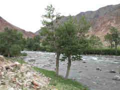 |
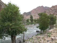 |
| The river Bulgan-Gol | The river Bulgan-Gol | The river Bulgan-Gol |
Along the river is the unpaved road. The put in (or take off) point can be reached from lower reaches via somon center Bulgan (do not confuse with another Bulgan in upper section of the river) or from upper reaches side of the river - from Olgii town via Tolbo and Deluun. The river is fed by rain and partially by glaciers and snow melting. The difficulty of rapids depends from water level in the river; at low water level can be shallow in places.
 |
 |
 |
| Bulgan-Gol upė | Bulgan-Gol upė | Bulgan-Gol upė |
Detailed river guide
0.0 Left tributary the Yoltyn-Gol. The river valley is wide, the width of riverbed is 20-25 m, in places up to 50 m. In the river stones, small boulders, local easy rapids separated by a relatively rapid current intervals. In places in the river islands. The height of the put in point 2040 m above sea level. Average gradient to tributary the Nariin-Jargalantyn-Gol 5.5 m/km. WW 2-, max. WW 2.
5.0 Right tributary the Ikh-Jargalantyn-Gol.
7.0 At the right bank the mountain. Before it short rapid. WW 2+/3-. The river in the rapid narrows up to 10 m
7.6 Bridge. The river valley wide again.
8.9 Right tributary Dund-Jargalantyn-Gol. In the river in places islands, branches. WW 2-, max. WW 2.
19.1 Right tributary the Nariin-Jargalantyn-Gol. Average gradient to tributary the Khuzhirtyn-Gol 5.21 m/km.
20.1 Bridge. Right village Bulgan, center of sommon.
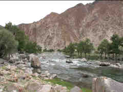 |
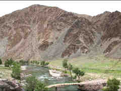 |
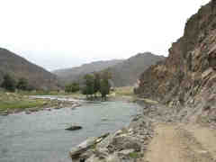 |
| The river Bulgan-Gol | The river Bulgan-Gol | The river Bulgan-Gol |
23.9 Left tributary Khuzhirtyn-Gol. Average gradient sheds and stockyards at left bank 4.29 m/km. The river valley narrovs, the river flows through gorge.
25.2 Right tributary Tulantyn-Gol. In the riverbed stones, boulders, easy rapids separated by a relatively rapid current intervals. In places islands, river divides to branches. WW 2, max. 2+.
38.3 Left sheds and stockyards. Average gradient to the creek from the left 5.2 m/km.
46.0 A large river loop around mountain at the left Khoit-Ueuur (2048 m height). Downstream a few local rapids up to WW 2+.
49.6 The river flows in one riverbed, width approx. 20 m. To tributary Turgen-Gol local rapids, a few of the up to WW 3-.
52.4 Left watery tributary Turgen-Gol flows from Munkh-Khairkhan mountains range. The tributary is fed by melting glaciers. Downstream the river flows through gorge, rare islands and the sometimes divides to branches. The rapids of various length from Grade WW 2+ to WW 4-(4) separated by swift current intervals. Up to left tributary 3 more difficult rapids.
 |
 |
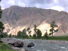 |
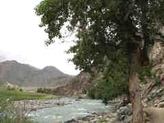
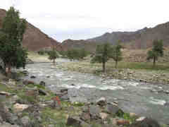
| The river Bulgan-Gol | The river Bulgan-Gol | The river Bulgan-Gol |
55.2 Left the creek. Average gradient to tributary Chachirtyn-Gol 8.38 m/km. Character of the river does not change. To tributary the Ikh-Tumurtyn-Gol a few more difficult rapids
57.9 Right tributary the Ikh-Tumurtyn-Gol.
58.7 Right village.
61.1 Right tributary the Dund-Tumurtyn-Gol. Village ends.
61.9 Right sheds and stockyards. In the river rapid approx. Grade WW 4- (4).
63.2 Bridge. Difficultyis of the river slightly decreased. Swift current intervals between rapids is longer.
66.3 Left tributary Chachirtyn-Gol. The river more difficult again. Average gradient to tributary the Indertiin-Gol 6.82 m/km.
79.2 Right tributary the Indertiin-Gol. At the tributary long rapid approx. WW 3+. Average gradient to tributary the Toshiltyn-Sala 11.05 m/km.
 |
 |
 |
| The river Bulgan-Gol | The river Bulgan-Gol | The river Bulgan-Gol |
79.5 Bridge. 300 m downstream rapid approx. WW 4-. In the river rapids from WW 2+ to WW 4, between them intervals of moderate current.
82.1 At the creek from left rapid approx. WW 4.
85.8 Left tributary the Deed-Nariin-Salaa. Approx. 300 m downstream rapid WW 3+/4-.
91.1 Right tributary the Toshiltyn-Sala. Average gradient to tributary Jargalant-Sala 5.22 m/km. Difficulty of the river decreases to WW 2+/3-. Intervals between rapids is longer.
96.2 Left tributary the Dood-Nariin-Gol. Difficulty of the river decreases to WW 2+. Intervals between easy rapids is long..
102.3 Right tributary the Jargalant-Sala. A few kilometers upstream from the tributary difficulty of the river decreases. Downstream in the river very easy rapids, the river in places divides to branches, islands. The river leaves the gorge, Upė išteka iš tarpeklio, valley gradually widens. WW 1/1+, max. WW 2. Average gradient to tributary the Bayan-Gol 4.56 m/km.
120.5 Right tributary the Bayan-Gol. The river leaves the mountains, valley very wide, the river divides to branches. To center of somon Bulgan village 32 km by unpaved road.
© J.D.Endriukaitis


